LAKE COUNTY, Calif. — The Lake County Registrar of Voters office reported that the official canvass for the March 5 primary is underway, with thousands of ballots still to be counted.
The agency said the results for the primary posted so far are not final, with the Elections Office now in the midst of the 30-day official canvass period.
As of Friday, still to be counted were 8,059 vote-by-mail ballots, 266 provisional/conditional ballots and 149 vote-by-mail ballots that require further review for various reasons, for a grand total of 8,474 ballots.
In addition, the Registrar of Voters Office reported that the deadline for elections officials to receive vote-by-mail ballots returned by mail for the March 5 Presidential Primary Election is March 12 if it is postmarked on or before Election Day and delivered to the elections office by the US Postal Service or a private mail delivery company no later than seven days after Election Day.
Elections officials said there are many checks and balances when certifying the election results. The process of certifying election results, also known as the official canvass, is mandated by state law to make sure the public can have confidence in the integrity of the final results. Staff members are working very diligently on completing all tasks required to certify the election.
“Vote-by-mail” ballots must be examined by staff to see if the signature compares with the voter’s signature on file.
After the vote-by-mail voter’s information has been entered and proofed, the vote-by-mail envelopes have to be sorted by voting precinct. Staff must verify the number of vote-by-mail processed by the voting precinct before the envelopes can be opened. Once staff balances, the envelopes can be opened.
“Polls provisional ballots” are cast at the polling places on Election Day. Some of the reasons a voter is issued a Provisional Ballot:
• The voter’s name is listed on the active voter roster list as a vote-by-mail voter and the voter is unable to surrender his/her vote-by-mail ballot in order to be issued a polls ballot. • The voter’s name is not printed in the roster-index, has moved and did not re-register to vote at his/her new residence address. • A voter is voting in the wrong voting precinct and not his/her assigned voting precinct. • A first time voter who is required to provide ID, but is unable to do so. • The voter’s eligibility to vote cannot be determined by the poll worker.
“Conditional voter ballots” issued to a person who missed the regular voter registration deadline of Feb. 20 but they still have the option to vote in an election by conditionally registering to vote and casting a conditional ballot (same day voter registration).
Voters that were allowed to sign the roster-index and issued a ballot at their assigned polling place, their voted ballot was counted at the Registrar of Voters office, on Election Night.
In addition, all of the roster-Indexes must also be examined for errors or omissions. Staff checks the ballot statement including the number of returned voted ballots against the number of voters who signed the roster-index.
Provisional and conditional voter signatures also need to match the number of voter provisional and conditional ballots. Once this is done, staff must enter voter history from each of the roster-indexes and record it into the voting system as voter history.
For more information call the Registrar of Voters Office at 707-263-2372 or toll-free at 888-235-6730.
CLEARLAKE, Calif. — Lake County Campus of Woodland Community College invites community members to join them in their celebration in honor of Women’s History Month with a panel discussion among “Women in Education.”
The event will be held Thursday, March 14, from noon to 1 p.m. in room 715.
This panel discussion will bring together a dynamic group of women leaders in education to discuss their experiences, challenges and triumphs in education.
New Woodland Community College President Dr. Lizette Navarette will lead the panel, which will include Lake County Campus interim Dean Patricia Barba, Konocti Unified School District Superintendent Dr. Becky Salato, Lake County mental health practitioner and Konocti Unified Board Member Zabdy Neria and Angela Cuellar, Lake County Office of Education QRIS director and early childhood education adjunct instructor for Woodland and Mendocino colleges.
Lunch will be available for purchase at Aromas Café from 11:30 a.m. to 1 p.m.
For more information contact Mary Wilson at 707-995-7913 or This email address is being protected from spambots. You need JavaScript enabled to view it..
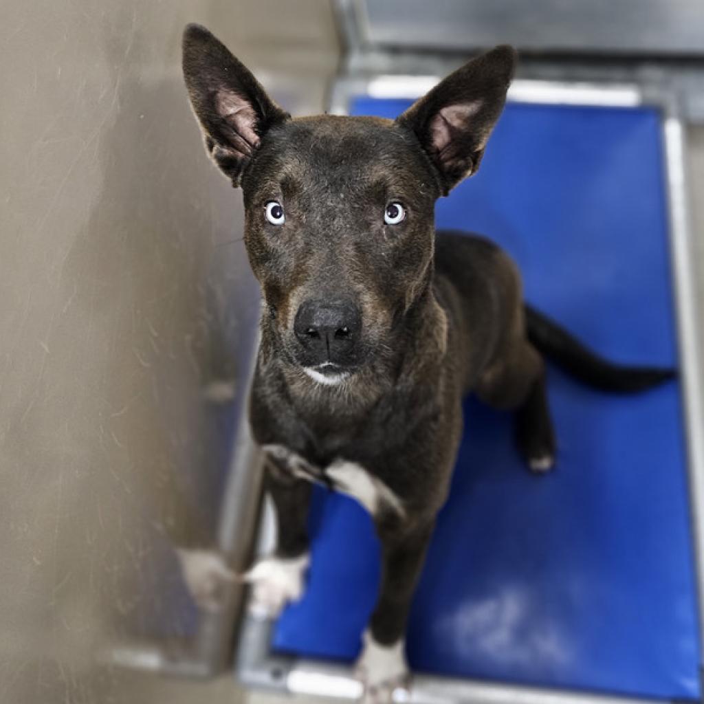
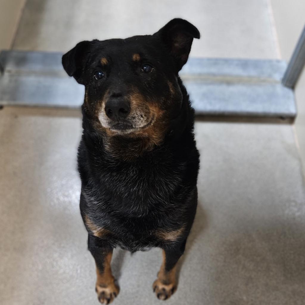
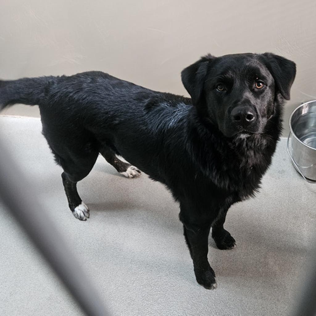
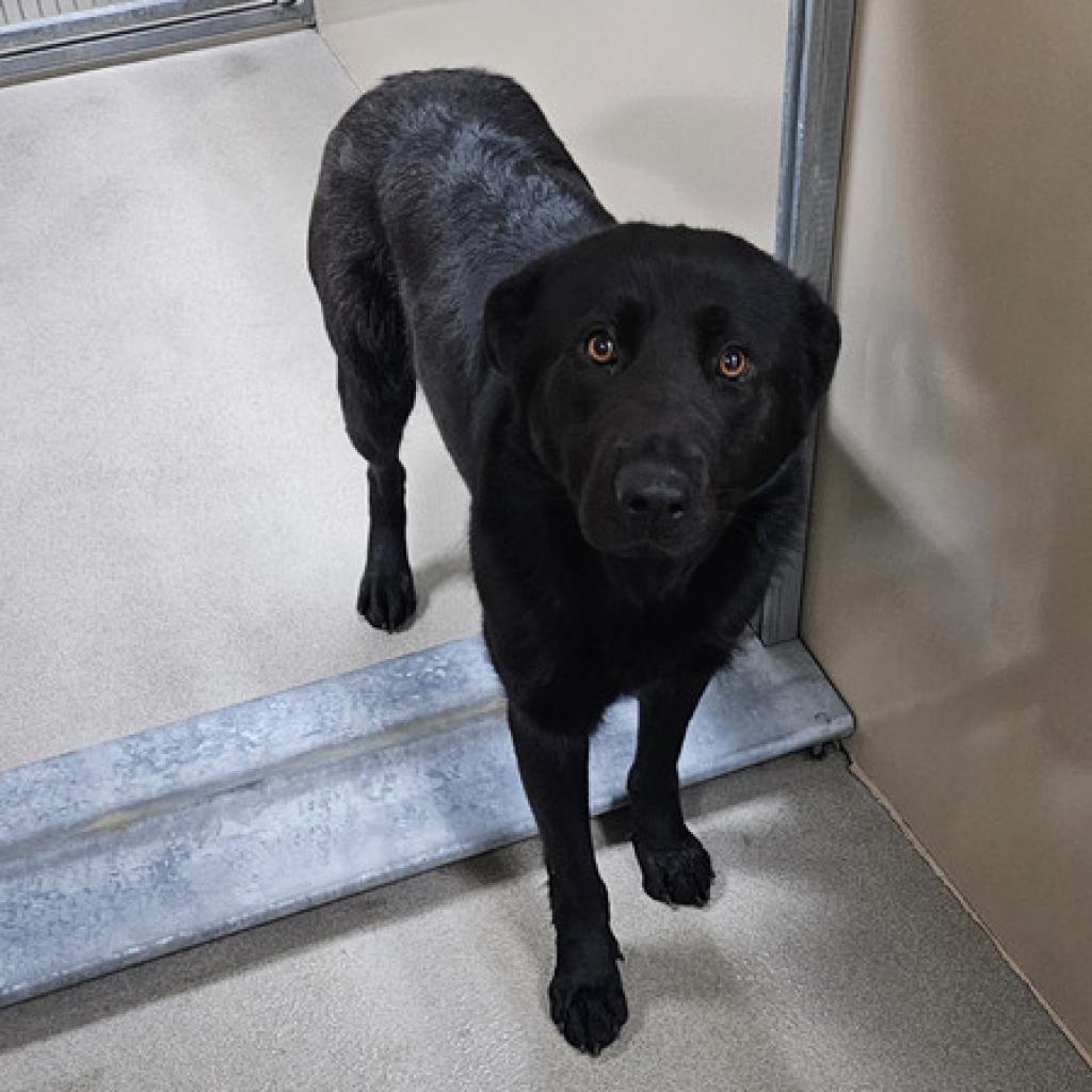
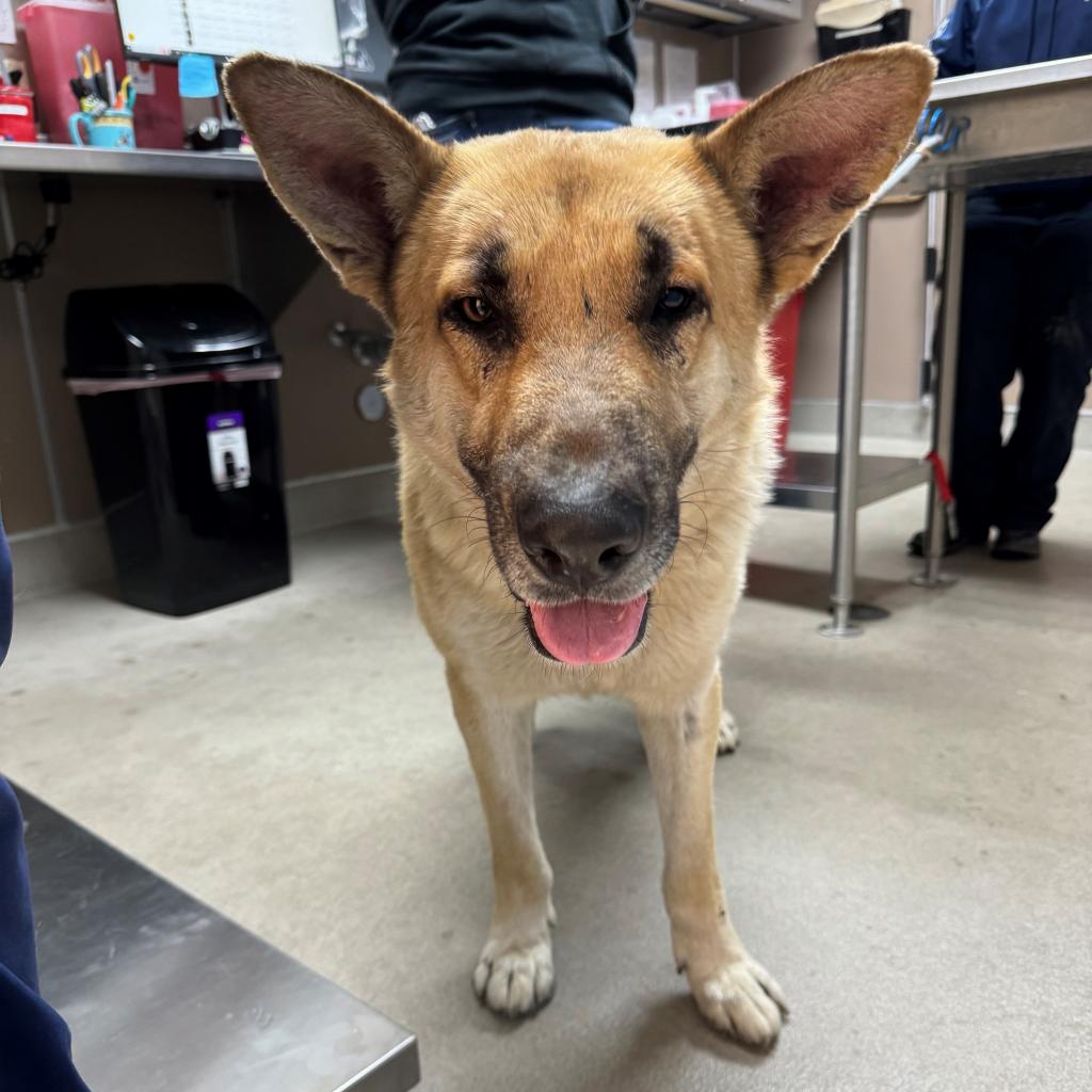
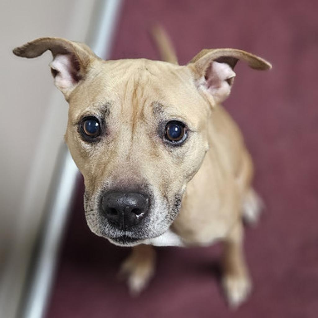
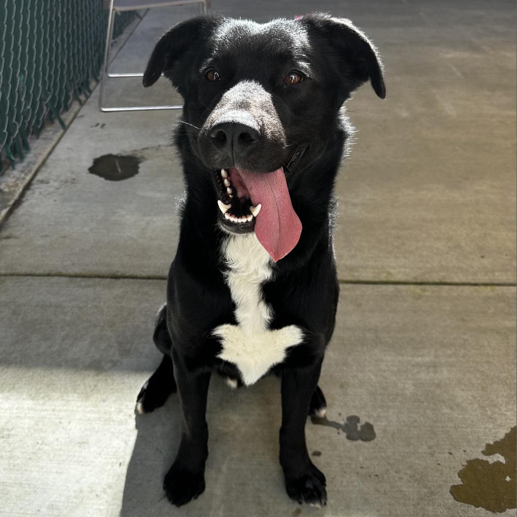
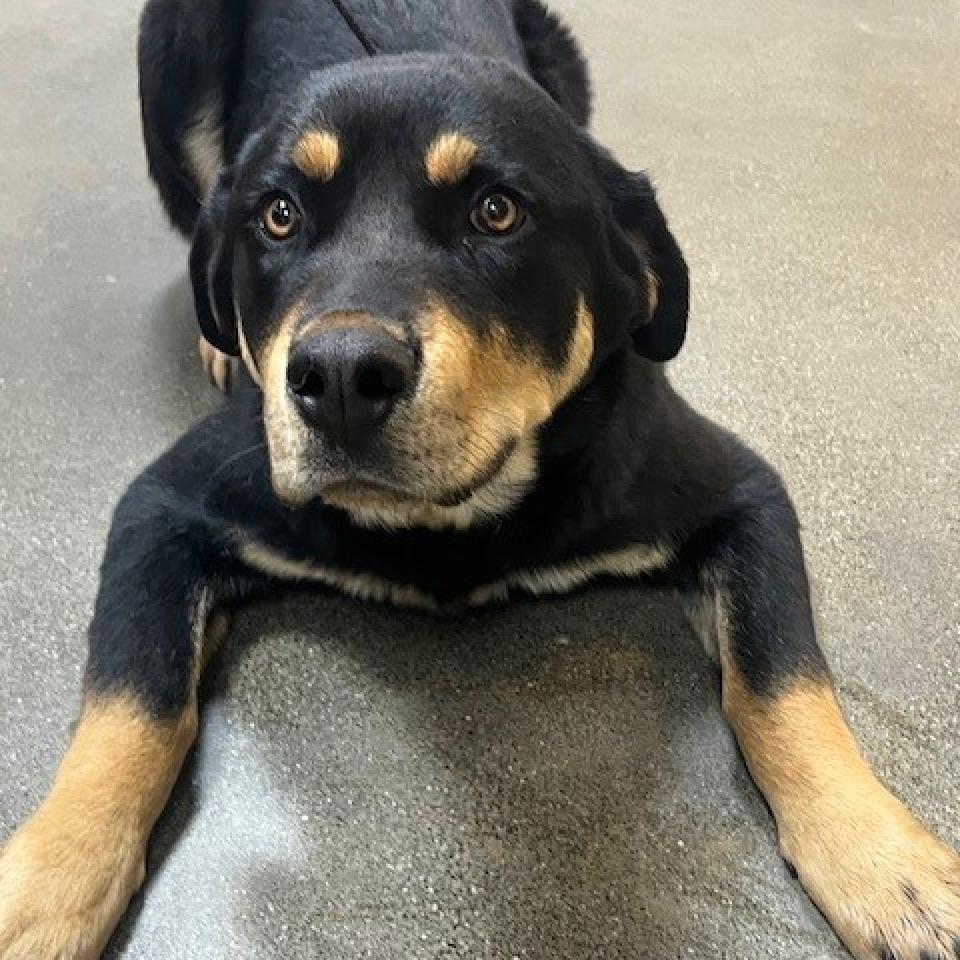
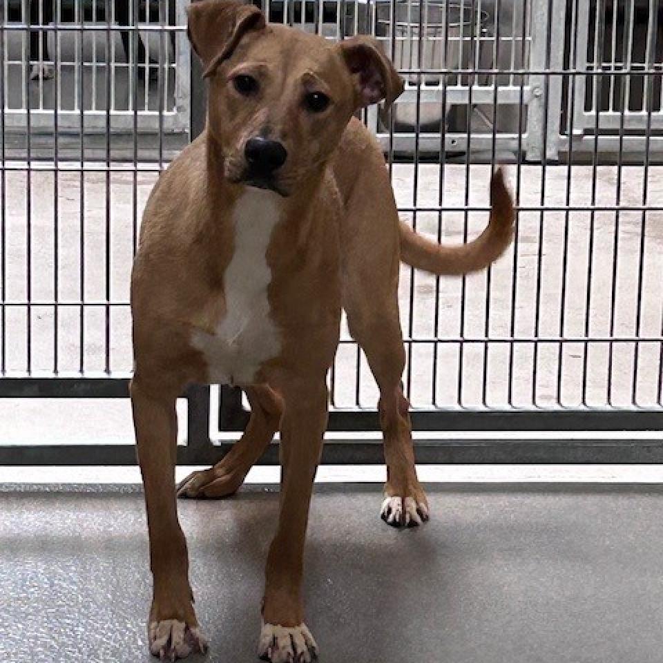
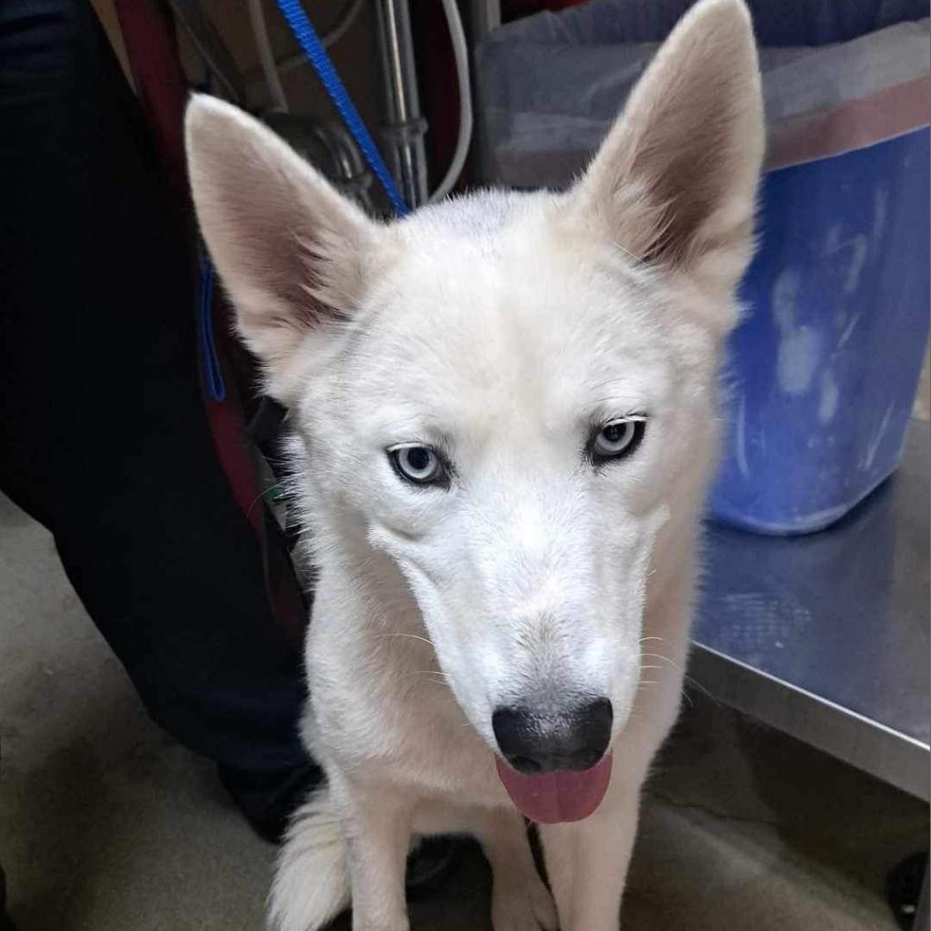
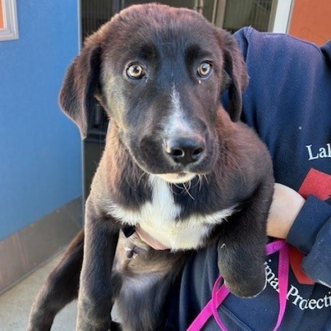
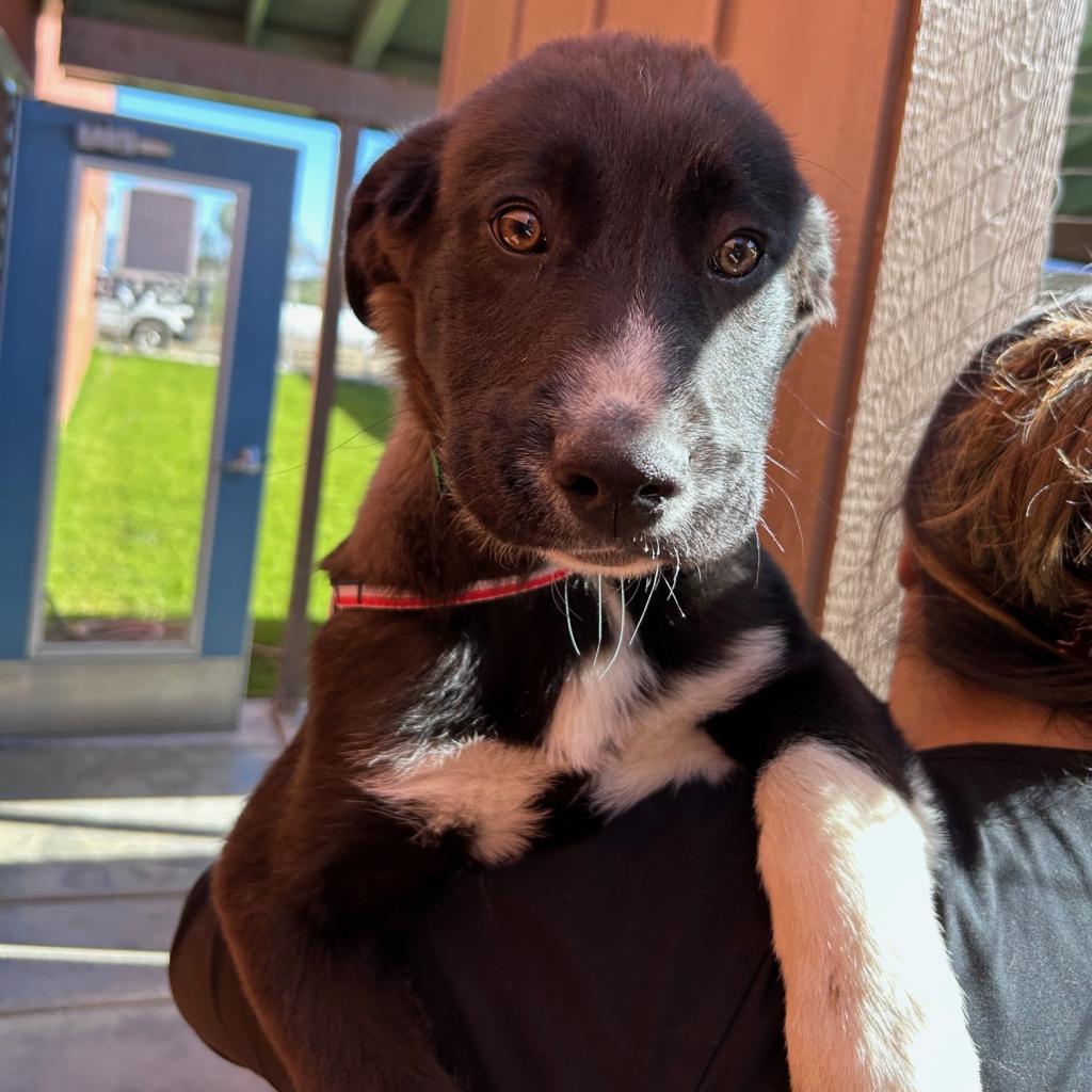
LAKE COUNTY, Calif. — Lake County Animal Care and Control has a variety of dogs waiting for new homes this week.
Dogs available for adoption this week include mixes of Australian shepherd, border collie, boxer, German shepherd, hound, husky Labrador retriever, pit bull, Queensland heeler, Rottweiler, shepherd and terrier.
Dogs that are adopted from Lake County Animal Care and Control are either neutered or spayed, microchipped and, if old enough, given a rabies shot and county license before being released to their new owner. License fees do not apply to residents of the cities of Lakeport or Clearlake.
Those dogs and the others shown on this page at the Lake County Animal Care and Control shelter have been cleared for adoption.
Call Lake County Animal Care and Control at 707-263-0278 or visit the shelter online for information on visiting or adopting.
The shelter is located at 4949 Helbush in Lakeport.
Email Elizabeth Larson at This email address is being protected from spambots. You need JavaScript enabled to view it.. Follow her on Twitter, @ERLarson, or Lake County News, @LakeCoNews.
Clear Lake enters March more than full with another half a foot forecasted within the week. A full lake means high waters and localized flooding around the shoreline, but it also makes for some incredible views. P: A. De Palma-Dow Feb 2024. Dear Lady of the Lake,
Is there an easy and quick way to learn about the stream and lake levels in Clear Lake? I was also wondering what your expert guess/prediction would be on the Rumsey level of Clearlake after this current storm passes through?
Thank you,
- Lake Level Larry
Hello Larry,
Great question and perfect for this time of year! We have been getting quite a bit of rain and that means the creeks and streams will have high flows of water, which do flow to Clear Lake. Every year I get lots of questions about how the stream and lake levels are measured and where that information can be found.
Lake and stream level data is collected from permanent gauge stations. Usually these gauges are installed, calibrated, and quality controlled by state or federal agencies. The majority of gauges situated around Lake County are managed by the United States Geological Survey, or USGS, and California Department of Water Resources, or CDWR.
Gauge technology has come such a long way! The internet has helped. Most government funded gauges are connected to a website where real-time or updated measurement data can be viewed and downloaded.
Gage / Gauge language
Before you start to write me that email about my use of gage vs. gauge, please read the following disclaimer where I directly address the gage / gauge spelling issue.
While I have received many, many emails providing me the right gage/gauge to use, here are some gauge facts. The vernacular use of “gage” and “gauge” can be used interchangeably and both can be used as a verb or a noun. Technically, the word “gage” is a different word altogether (it means to throw down a challenge, like a knight proposing combat). But while knighthood battles are mostly extinct, the word “gage” is still maintained in the English language.
The USGS has a historical affinity for the use of “gauge”, but more recently uses gage (for any of the USGS plot displays, the word “gage” is provided). According to Merriam-Webster Dictionary, considering global use, “gauge” is the preferred variant of this word and is more commonly used than “gage”. According to ESL.com, the word “gage” is becoming obsolete.
If you ask the Lady of the Lake, life is too short to gauge your happiness by the amount and type of gages being counted, but don’t mind me and pick the gauge/gage that is right for you!
Now, back to the vocabulary.
Below we will cover some stream gage terminology that will be useful when accessing and viewing stream gage data websites. Like most things in science, there are specific terms that are used to distinguish units of measurement so that there is no confusion when communicating information.
Stream stage = height of the water from the bottom of the gage located within the stream, which may or may not reflect the deepest part of the stream. Stream bottoms and sides can change in depth as sediments move, shift, get pushed around or pile up.
However, a permanent gage station will always report the stream gauge from a stationary fixed point so that the data collected over time is consistent and comparable and not reflective of changing stream bottom. Usually stream gauge locations are selected to be where the least amount of change in a stream will occur, but variation is always common in natural systems. Most technically advanced gauges these days are calibrated with elevation considered into the transducer that measures the water depth.
Stream flow or discharge = this is velocity or speed of the water and the amount of water flowing past the point where the measurement is being collected, generally at the gage station. For example, the discharge of Middle Creek during any given storm could be 1,400 cubic feet per second, or CFS or ft³/s. So in one second, about 1,400 cubic feet of water passed the gauge on Middle Creek. That is quite a bit of water for our regional creeks, but to put it in perspective, The Mississippi River has an average discharge of 593,000 CFS!!
Forecast = a statement of prediction. For the stream gauge, the river forecast visually shows predicted conditions of stream stage, flow, discharge, and sometimes even precipitation based on climate data and expectations for upcoming weather.
Guidance = is the modeled predicted conditions of stream stage and flow. Usually this is based on years of previous data and models, in conjunction with forecast information. Guidance is more of a “sure thing” than forecasted data, but they are both expectations of future conditions and are subject to change.
Current stream and river stage and flow data
There are lots of resources available online for anyone to access real-time stream and river data. I will share two of my favorites with you. I suggest you take some time and explore these resources to see all they have to offer, which can be quite a bit of information that can be useful in different ways.
My personal favorite site is the California Nevada River Forecast Center. The California Nevada River Forecast Center, or CNRFC, is a field office of the National Weather Service located in Sacramento, California. The CNRFC is co-located with the Sacramento NWS Forecast Office, CDWR, and United States Bureau of Reclamation. The NWS is an agency of the National Oceanic Atmospheric and Administration, or NOAA, under the United States Department of Commerce.
I can not emphasize enough how much I love this website; I have all of our county and Lake gage pages from this website bookmarked on my phone browser and my work and home computers. I have used this website for many projects from monitoring post-fire debris flows, first flush stormwater monitoring, and flood preparation and flood watch.
It is also very user friendly and displays a lot of very useful information in only one or two scrolls on a computer or smart phone. The graphical plot of past, current, forecast, and guidance data is easy to view and easy to understand.
If you are new to this website, and need some guidance, you can refer to this video I made, from a previous column, that walks through the website to get to the data display and stream plots for local data.
In this video tutorial, Lady of the Lake demonstrates how to access local stream gauge information on both the California Nevada River Forecast Network and California Data Exchange Center Websites.
Water Resource managers use stream stage data regularly. Safe operation of diversion structures, weirs, or dams are dependent on the opening or closing of structures and gates at certain thresholds of stream stage or flow. Predictive gage information is valuable because it allows managers to monitor multiple stream gage sites at once without having to sit on site in potentially hazardous conditions for hours waiting for the threshold to hit.
Prediction data is also wonderful in that it allows the public to use the same tools that are available to researchers and agencies - making it easy for everyone to be best prepared when conditions change are of a concerning nature.
Additionally, during spring when Clear Lake Hitch are starting their spawning migrations upstream, the flow data in streams around Clear Lake is being used to help identify preferred conditions for hitch and reproduction success. This information is playing a huge role in the management and recovery of this important and state-threatened fish species.
If you live adjacent to a stream or river and are concerned about flooding, I would look into exploring if a stream gauge is located somewhere on that stream system. You don’t need to be near a stream gauge for the data to provide value, as long as one is located somewhere along the stream.
Some gage stations even have automatic alerts you can set up on your smartphone that will automatically send a text message should a specific river or stream reach a certain stage or flow. A good place to learn about such a tool is USGS WaterAlert.
The next resource is California Data Exchange Center, or CDEC. This website is managed by CDWR and while it does have some prediction power, the majority of gage information here is real-time and archival. However, it’s pretty easy to use and has a large network of gauges and data that expands across all of California.
One thing about the CDEC is the data is focused on river information. The tabs at the top of the home page provide a lot of the type of data and tools available, and makes it easy to search for what you might need. Historic water data is also easily available on CDEC, making it easy to conduct a study on your local stream or river.
One thing to be aware of with CDEC is that the website can get pretty busy and bogged down during popular use times. If there is a heavy storm event and people and agencies are looking for river data and flood conditions, this website might get really slow and pages might not load as quickly, so be patient.
Also, CDEC usually doesn't provide forecast or guidance data on their plots, that is something that CNRFC specializes in with their partnership with USGS.
Measuring lake levels
Clear Lake level is determined in a very unique way, different from all other lakes and reservoirs. Clear Lake uses the Rumsey gauge to measure lake levels. I described this in my column, “Learning about Lake Levels” from Oct. 17, 2021 and again in “Revisiting Lake Levels and Lake Hazards” from March 2023.
Daily lake level data is measured from an in-lake gauge (#11450000, CNRFC gage CLKC1) operated and maintained by the USGS and housed at the lakeside Lake County Vector Control District Offices and be accessed online here.
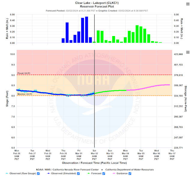
Figure. Screen shot of the California Nevada River Forecast Center Clear Lake gage showing the current lake level as of March 2, 2024 (8.2 feet Rumsey) and the forecasted next 6 days of both precipitation and associated Clear Lake level rise. Shaded regions depict flood condition windows with orange (8.0-9.0 ft. Rumsey) indicating monitor stage and red region (9.0 ft. Rumsey and above) indicating flood stage. Accessible at : https://www.cnrfc.noaa.gov/graphicalRVF.php?id=CLKC1 Last year, during the wet season after we were coming out of a 3-year drought, I wrote a column about predicting lake level rise. With the lake starting at negative Rumsey, it was hard to predict exactly how much rain was needed to get to a full lake.
Luckily, CNRFC has added lake level forecasts into their models and displays this information on their lake level plot. The period of the line in green is reflective of the forecast based on previous 6-day trends of the precipitation and lake level rise. The portion in pink is the guidance, or estimated lake level.
Larry, here is where you can answer your question about the expected lake levels. Using the CNRFC plotted forecast information, the lake level is expected to rise to 8.5 ft Rumsey by the end of this current storm event that ends Wednesday.
In general, once the lake is full at 7.56 feet Rumsey, and the watershed is saturated from several storm events, the rise of the lake corresponds to about 1 inch rise for every 4 to 5 inches of rain. So, if we got 5 inches of rain, we would expect to see about 1 feet of lake level increase.
Logistically, the lake is rising from the rain itself (collecting in the lake) and the collection of runoff from the landscape and tributaries flowing into the lake contributes to the lake level increase. According to the Lake County Water Resources Department Historical Levels of Clear Lake High and Low there is 10% chance of getting to minor flood stage, and 1% chance of the lake getting to major flood stage in any given year.
Also, the Lake County Water Resources Department monitors the daily lake level and can provide that to you by phone at 707-263-2344, if you do not have access to the website and they have all the links for all the regional gages, located on their website at the “Hydrologic Information” Tab located here.
Clear Lake water level lowers slowly
It's important to understand that if the lake reaches a critical flood stage, there is nothing that can be done to magically make the water recede “faster” because the water has to work its way out through the Grigsby Riffle and Cache Creek dam. Therefore, it’s up to the residents who live in low lying areas to be prepared in the event of high water and resulting flood conditions.
The reason why water leaves the lake so slowly is because there is only one outflow compared to the many inflows. The single outflow of the lake is located in the Lower Arm past Anderson Marsh State Park. The outflow becomes constrained within a natural rock and gravel formation called the Grigsby Riffle located in Cache Creek. The water then flows through Lower Lake and to the Cache Creek Dam managed by Yolo County Flood Control and Water Conservation District.
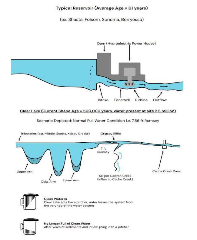
To better understand how lake levels and flows interact over the Grigsby Riffle and into Cache Creek, you have to understand how Clear Lake is different from Reservoirs. The Water Resources Department recently created a profile infographic that depicts the lake basins and how water flows into the lake and out through the Cache Creek dam during different water scenarios and how it’s connected to Cache Creek.
Figure. Infographic showing the difference between an outlet of a typical reservoir in the United States and California and a naturally-formed lake like Clear Lake. Clear Lake has passive flow out of a natural channel at the surface of the water column, while reservoirs are built to release water from the bottom of the basin to generate hydropower. Graphic provided by Lake County Department of Water Resources. Whether the lake is baseline full at 7.56 Rumsey or in flood stage, there is a maximum amount of water that can flow over the Grigsby Riffle and into Cache Creek. Opening the dam gates does keep that water flow in Cache Creek consistent and moving, but there is a maximum flow of water that can move over the Grigsby Riffle which is about a 4,700 CFS maximum even when the lake is at peak flood (11 ft Rumsey).
When you live on or around Clear Lake, one of the most important things to understand about flow leaving Clear Lake is that the Cache Creek Dam does not control the amount of water that can flow from the lake and the dam does not cause flooding around the lake.
The Cache Creek dam is actually built for a bigger stream system than what Clear Lake can provide down to Cache Creek. Cache Creek Dam is designed to release water at 21,000 cubic feet per second (cfs). However, Clear Lake outflow, combined with Siegler Creek outflows, deliver less than 4,700 cfs even when Clear Lake is at 11 feet Rumsey.
To put these numbers into perspective, 2,700 cfs will fill a typical in-ground, backyard swimming pool in 1 second. These flows show that the Cache Creek dam can release almost 4.5 times as much water as can reach it even during severe flood events on Clear Lake.
More information on the history and flow testing to demonstrate the above scenario of the Cache Creek dam and flow from Clear Lake, you should visit the Lake County Water Resources Cache Creek Dam Flows webpage.
Flooding and other Emergency Information
It’s important to monitor the lake stage so you can be prepared for any flooding events due to high water in the Lake. First, be aware of current conditions, bookmark the lake gauges on your browser, on your computers and mobile phones. Check them often as storm events occur and after, as stream flow continues to increase lake water levels even after precipitation has stopped.
In the meantime, the best course of action to prevent loss or damage to property due to flood, is to be prepared. The County of Lake Office of Emergency Services released a series of “Flood Prep” best practice tips for being prepared against disaster during flood season.
Road closures, due to flooded conditions, can be located on Zone Haven https://aware.zonehaven.com/search along with information for when they are reopened and safe for travel.
Additionally, The Lake County Department of Public Works - California facebook page usually posts the most recent list of locations to purchase sandbags and sand bag assembly materials.
For more information about shelters, or emergency services, contact the Lake County Office of Emergency Services or call them at 707-263-3450.
Sincerely,
Lady of the Lake
Angela De Palma-Dow is a limnologist (limnology = study of fresh inland waters) who lives and works in Lake County. Born in Northern California, she has a Master of Science from Michigan State University. She is a Certified Lake Manager from the North American Lake Management Society, or NALMS, and she is the current president/chair of the California chapter of the Society for Freshwater Science. She can be reached at This email address is being protected from spambots. You need JavaScript enabled to view it..
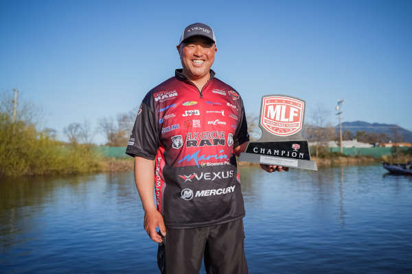
Ken Mah. Photo courtesy of Major League Fishing. LAKEPORT, Calif. — In his 18th season fishing the Western Division Presented by Tackle Warehouse, Elk Grove, California’s Ken Mah has finished 11 times in the Top 10.
He’s been close so many times before, and Friday at Clear Lake, he finally added the big No. 1 to his MLF résumé.
Mah didn’t just eke by, either. The Toyota Series Presented by Phoenix Boats veteran went absolutely nuclear the final two days of the event, weighing in close to 30 pounds on Day 2 (29-12) and putting the cherry on top on Championship Friday with the largest bag of the tournament (31-10) that was anchored by a behemoth Clear Lake 11-pounder. In total, he weighed in 15 fish for 82 pounds, 6 ounces over three days.
As was the case for many anglers this week, Mah didn’t pile up big weights with big numbers – he had just nine bites on Day 1, 11 on Day 2 and seven on Day 3 — but he got the right bites at the right times, as evidenced by the tournament-best 11-pounder, which he caught mid-morning Friday.
What separated Mah from many in the field was the way he caught his fish, namely, flipping shallow cover. While the majority of anglers were casting big swimbaits offshore, Mah spent his time flipping, at first somewhat offshore and eventually near the bank.
“I [caught] my biggest one near the bank,” he said. “That was late in the day on Day 1. And that kind of clued me in a little bit. As the tournament went on, I started to catch less and less of them out of the brush and more and more on the bank. That was a key move for me.
He added, “I followed those big fish. They want to move shallow right now. Me being able to follow them shallow was a key adjustment.”
Adjusting on the fly was perhaps part of Mah’s plan, though. After snowfall during practice and with forecasts calling for increasingly warmer weather throughout the week, he knew he’d have to move with the fish and try something a little different at some point.
For his flipping setups, Mah relied on a black-and-blue jig with a 3-inch Big Bite Baits YoMama trailer tied to 65-pound-test braid spooled on a Shimano Chronarch 150 MGL reel paired with a G. Loomis GLX 894. He also flipped just the YoMama on 22-pound-test Sunline Shooter with the Chronarch and a G. Loomis GLX JWR895.
Mah isn’t one to play up his accomplishments (and despite this being his first MLF win, he’s won all over the place out West on other tournament trails), so he was somewhat understandably subdued about catching more than 61 pounds over the final two days of the tournament. Still, it wasn’t entirely lost on him what a crazy tournament he put together.
“I didn’t know what was going to happen,” he said. “I knew the weather conditions were getting better for what I wanted to do. Things came together. It was [just] one of those things.”
With the win, Mah not only finally has a shiny red trophy to add to his mantle but also finds himself in the driver’s seat for Western Division Angler of the Year. Of course, there’s still two tournaments to go — and he’s not overlooking either of them — but he’s experienced enough with the West Coast slate to really put an exclamation point on what has been a terrific FLW/MLF career to this point, not to mention the fact that the Western Division finale takes place on his home fishery of the California Delta.
First, though, is Havasu in May, which is a timeframe that presents some new challenges for Mah and the rest of the division.
“My attitude about the season and each tournament is a microcosm,” he said. “Getting off to a great start is a great thing, but it’s not about how you start – it’s how you finish.
“I’m cautiously optimistic. We’re going to Havasu at a different time of year that I’ve not been before. With that postspawn Havasu fishing, it should suit my style better than the usual pre-prespawn time. I’m looking forward to it.”
And why not? There’s a sense of relief that comes with notching your first MLF win.
“It’s one that was alluding me,” he admitted. “To close it out here against this field, it’s just amazing. I’m blessed. This is a trophy I’ve been chasing.”
The top 10 pros on Clear Lake finished:
1st: Ken Mah, Elk Grove, Calif., 15 bass, 82-6, $26,261 2nd: Joe Mariani, Winters, Calif., 15 bass, 76-4, $10,176 3rd: Jon Strelic, El Cajon, Calif., 15 bass, 74-1, $7,878 4th: John Pearl, Upper Lake, Calif., 15 bass, 73-13, $6,565 5th: Christian Melton, Menifee, Calif., 15 bass, 68-3, $5,909 6th: Nathan Phillips, Kelseyville, Calif., 15 bass, 67-15, $5,252 7th: Juarez Jackson, Kelseyville, Calif., 15 bass, 66-5, $4,596 8th: David Valdivia, Riverside, Calif., 15 bass, 65-4, $4,239 9th: J.D. Blackamore, Yorba Linda, Calif., 13 bass, 65-0, $3,283 10th: Patrick Touey, Santa Maria, Calif., 15 bass, 61-12, $2,626
Complete results can be found at MajorLeagueFishing.com.
Pro Daniel Shelton of Kelseyville, Nevada, earned the $500 Berkley Big Bass Award on Day 1 Wednesday with a largemouth weighing in at 9 pounds, 4 ounces. The Day 2 $500 Berkley Big Bass Award on Thursday was earned by pro Roy Hawk of Lake Havasu City, Arizona, with an 8-pound, 14-ounce largemouth bass.
Kirk Marshall of Discovery Bay, California, won the Strike King Co-angler Division Friday with a three-day total of 13 bass weighing 52 pounds, 2 ounces. Marshall took home the top co-angler prize package worth $33,500, including a new Phoenix 518 Pro bass boat with a 115-horsepower Mercury outboard motor.
The top 10 Strike King co-anglers on Clear Lake finished:
1st: Kirk Marshall, Discovery Bay, Calif., 13 bass, 52-2, Phoenix 518 Pro boat w/115-hp Mercury outboard 2nd: Jonathan Green, San Pablo, Calif., 13 bass, 50-7, $3,396 3rd: Blaine Christiansen, San Jose, Calif., 12 bass, 49-12, $2,716 4th: David Zavvar, Concord, Calif., 13 bass, 44-12, $2,377 5th: Jerimiah Valador, Kelseyville, Calif., 10 bass, 44-5, $2,187 6th: Mike Walsh, El Cajon, Calif., 10 bass, 42-13, $1,848 7th: Troy Diatte, Salinas, Calif., 12 bass, 42-1, $1,358 8th: Jose Juarez, Jr., Kelseyville, Calif., 11 bass, 41-0, $1,188 9th: Paul Buccola, Dayton, Nev., 12 bass, 40-10, $1,019 10th: Mike Alvarez, Clovis, Calif., 11 bass, 40-4, $849
Jerimiah Valador of Kelseyville, California, earned Wednesday’s $150 Berkley Big Bass co-angler award with a 6-pound, 7-ounce bass, while the Day 2 $150 co-angler award on Thursday went to Damon Witt of Riseville, California, with an 8-pound, 2-ounce bass.
The Toyota Series Presented by Phoenix Boats at Clear Lake was hosted by the Konocti Vista Casino Resort & Marina. It was the first of three regular-season tournaments for the Toyota Series Western Division Presented by Tackle Warehouse. The next event for the Toyota Series Western Division Presented by Tackle Warehouse anglers will be the Toyota Series at Lake Havasu, May 2-4, in Lake Havasu City, Arizona. For a complete schedule of events, visit MajorLeagueFishing.com.
The 2024 Toyota Series Presented by Phoenix Boats consists of six divisions – Central, Northern, Plains, Southern, Southwestern and the Western Division Presented by Tackle Warehouse – each holding three regular-season events, along with the International and Wild Card divisions.
Anglers who fish in any of the six divisions or the Wild Card division and finish in the top 25 will qualify for the no-entry-fee Toyota Series Championship for a shot at winning up to $235,000 and a qualification to REDCREST 2025. The winning Strike King co-angler at the championship earns a new Phoenix 518 Pro bass boat with a 115-horsepower Mercury outboard.
The 2024 Toyota Series Championship will be held Nov. 7-9 on Wheeler Lake in Huntsville, Alabama, and is hosted by the Huntsville/Madison County Convention & Visitors Bureau, the Madison County Commission, and the Huntsville Sports Commission.
Proud sponsors of the 2024 MLF Toyota Series include: 7Brew, Abu Garcia, B&W Trailer Hitches, Berkley, BUBBA, E3, Epic Baits, FX Custom Rods, General Tire, Lew’s, Mercury, Mossy Oak, Onyx, Phoenix, Polaris, Power-Pole, Strike King, Suzuki, Tackle Warehouse, T-H Marine, Toyota and YETI.
For complete details and updated information visit MajorLeagueFishing.com. For regular Toyota Series updates, photos, tournament news and more, follow the MLF5 social media outlets at Facebook, Instagram and YouTube.
BERKELEY, Calif. — In late January, seven engineers from the Berkeley Seismological Laboratory helicoptered into the Farallon Islands, a wind-swept, nearly treeless chain of islands 30 miles off San Francisco's Golden Gate, on an eight-day mission to upgrade one of the lab’s most remote — yet most critical — seismic stations.
The station is one of few in Northern California located on the western side of the dangerous San Andreas fault and is vital to the University of California, Berkeley's 181-station seismic network, which ties in with the U.S. Geological Survey's network to monitor earthquakes and provide data to warn Californians of seismic activity.
The MyShake app developed at UC Berkeley uses this network to give Pacific coast residents an early warning about potential shaking.
Yet, torrential rains and ferocious winds have taken their toll on the 30-year-old outdoor station on Southeast Farallon Island, the largest island within the Farallon Islands National Wildlife Refuge, a U.S. Fish and Wildlife Service preserve that is off-limits to the public and the largest seabird nesting site on the Pacific coast outside of Alaska.
The outdated seismic sensors were encased in a rock cairn as protection from the wind, but small seabirds called ashy storm petrels appeared to have burrowed in for protection as well. Invasive house mice had nested in the sensors’ electronic components.
Over the years, equipment maintenance had been spotty, typically only possible via a six-hour round trip by boat through rough seas.
“This was one of the first instruments put here when Berkeley started to build the Berkeley Digital Seismic Network in the 1990s,” said seismology lab director Richard Allen as he accompanied his crew on a survey of the outdated station. “It's been upgraded a couple of times since, but this is our opportunity to really turn this into a state-of-the-art site where we have much lower noise levels and we can really detect all earthquakes that are occurring in the region.”
On Jan. 30, when Allen and the engineers arrived, the air was filled with the squawking of sea lions a stone's throw away in a churning inlet. Their stay on the island was timed to avoid the upcoming nesting season for seabirds, such as petrels and Cassin’s auklets, whose nests completely surround the walkway where the station’s cables are laid.
But they couldn't avoid bad weather. The winter's worst storm ripped through during their stay, with gusts up to 75-miles-per-hour. The crew had to work in storm suits, while salt spray and rain rusted their tools within days.
“The Farallon site was always a noisy one anyway, because of storms and maybe birds. The refurbishment — it's really the equivalent of a brand-new station — will provide higher quality data and more reliability,” said Allen, UC Berkeley professor of earth and planetary science. “We don't want the station to go down.”
A desperately needed upgrade
The Berkeley Seismological Laboratory team has been upgrading seismic stations in the Northern California network for the past six years, in the process navigating around off-the-grid marijuana grows, repairing wires ripped up by bears and occasionally fixing vandalized equipment.
But the upgrade to the Farallon Islands station was, by far, the most exotic location with unique challenges. And it was a critical improvement, considering the San Andreas Fault’s proximity to San Francisco and a densely populated Bay Area.
Earthquakes usually originate along a fault line, so pinpointing the epicenter requires having sensors on both sides of a fault — four stations must detect a quake before triggering a warning through MyShake.
The ShakeAlert system that underlies MyShake and provides quake warnings to agencies and businesses throughout California has had only three false alarms out of 115 alerts sent out since it started operating in October 2019.
Two of the false alerts were for quakes off Cape Mendocino, near Eureka, where the San Andreas Fault sits offshore without any close monitoring stations to accurately determine location and magnitude. The other false alert was at the California-Nevada border, where the Berkeley Seismological Lab also has few stations.
“That's a pretty spectacular performance overall, but we miss earthquakes all around the edges of the network,” Allen said, stressing the need to upgrade the Farallon Islands site.
The effort required so much equipment — including rock drills and cabling — that seven round-trip helicopter flights from the Half Moon Bay airport were needed to deliver it and the crew. Between Jan. 30 and Feb. 7, the engineers constructed the new Farallon station and tested the sensors, bunking down in one of two unheated clapboard houses on the island.
What they found on the island was a dusty rack of electronic equipment dating from 1994 pushed to the side of what is now a cluttered carpenter shop, the only remaining portion of a barracks that had been built of rocks and cement in 1905.
The equipment was connected to broadband sensors located outdoors a hundred yards away, hidden under a pile of rocks glued together with spray foam. Holes in the foam contained feathers, testifying to the fact that birds had carved out nests there over the years.
Rusty communication antennas and an old GPS Radome, a structure that protects radar antennae from weather, rounded out the station's network.
At the end of the team’s mission, all the old equipment except for the rock-encased seismometers were dismantled and returned to Berkeley.
A network for the next generation
In their place, the team installed two types of accelerometers — a state-of-the-art strong motion sensor, which is the centerpiece of most seismic stations, and a broadband seismometer able to detect small quakes that often go unnoticed.
These instruments are now bolted to cement foundations, packed with glass beads inside a protective aluminum cylinder and sheltered from wind and animals by shiny, stainless steel boxes bolted to the rocks.
A new GPS antenna to measure horizontal movement sticks six feet into the air, supported by four struts epoxied into granite; new cables have been laid; new electronic equipment now rests inside mouse-proof cabinets in the carpentry shop; and a new antenna peeks above the shop's roofline to send real-time data to a receiver at UC San Francisco.
Thanks to months of planning and great teamwork, “things went shockingly well,” said Jonah Merritt, who led the team. “This was the most involved project we have ever pulled off, honestly.”
Berkeley Seismological Laboratory scientists are now calibrating the sensors and reviewing the data, part of a monthslong commissioning process required before any station is put on line.
The revamped Farallon station is among the last of UC Berkeley's stations to be upgraded, and because access to it is difficult, it was the most expensive, costing an additional $90,000 for transportation above the typical cost of an upgrade on the mainland.
Only four more stations remain. All have been funded by grants from the federal government through the USGS and the California Governor’s Office of Emergency Services. The entire ShakeAlert network of 1,675 stations from California to Washington is now 91% complete, Allen said, incorporating networks managed by UC Berkeley, California Institute of Technology and the USGS, as well as the University of Washington and University of Oregon.
UC Berkeley's network is also optimized for basic research on global seismicity and to study incremental movement along underground portions of the state's faults. One major area of the lab’s interest is whether smaller quakes, called microquakes, can provide more information about the deeply hidden geometry of faults and, maybe someday, pinpoint areas most prone to a near-term rupture, narrowing the window within which a quake is expected from a generation to perhaps a decade.
“All of the Berkeley stations have two sensors at them: a strong motion instrument and a broadband instrument,” Allen said. “That's good for earthquake early warning because now we have two sensors, and we actually look for both sensors to agree about the earthquake that's underway. The broadband sensor is a much more sensitive instrument, so it allows us to detect much smaller magnitude earthquakes. That feeds into the research goals, where we can detect these smaller magnitude earthquakes and use that to image faults and to understand the statistical properties of earthquakes much more rapidly.”
The seismic station upgrades insure a robust early warning system into the future, Allen said.
“We wanted to build a network not only for earthquake sensing,” he said, “but for the next generation.”
Robert Sanders writes for the UC Berkeley News Center.
The California Department of Water Resources will celebrate Groundwater Awareness Week March 10 to 16 to provide an opportunity for the public to learn about the vital importance of groundwater in all our lives.
Officials said 2024 marks the 10th anniversary of the signing of the Sustainable Groundwater Management Act, or SGMA. SGMA is California’s groundbreaking groundwater legislation, which passed in 2014, and established a statewide framework to protect the State’s precious groundwater resources.
Groundwater plays a critical role in water supply resilience for our state, our nation and worldwide.
Here in California, whether we are experiencing the weather extremes of drought or flood, or something in between, our groundwater basins provide a water supply for more than 15 million people, especially during dry years when surface water supplies are lacking.
As California adapts to a hotter, drier future, these groundwater supplies are becoming a more vital resource for local water agencies, communities and agriculture.
“In addition to promoting groundwater education during Groundwater Awareness Week, this year, we are celebrating the accomplishments that the local groundwater sustainability agencies have achieved over the first decade of SGMA, and the state-local partnerships we continue to build,” said Paul Gosselin, DWR deputy director of sustainable water management. “The local agencies are on the ground, in their communities, progressing towards a sustainable groundwater future for California, with support and guidance from DWR. In the first decade of SGMA, every ambitious milestone has been met, and we will continue to see progress as agencies implement their plans.”
Groundwater is nature’s hidden water resource that quenches our thirst and sustains our planet. Nearly 85 percent of Californians depend on groundwater and many communities are 100 percent reliant on groundwater for all their water needs, so chances are high that groundwater is a part of your life.
“Groundwater Awareness Week is a great opportunity to learn more about California’s vital water resource,” said Gosselin. “So, during this week, let’s all raise a glass to groundwater, the hardworking groundwater managers throughout the State, and the partnerships that are leading California to a sustainable water future.”
Whether you’re a groundwater guru, or you had no idea that there is water stored in the underground aquifers beneath your feet, there will be something for everyone during Groundwater Awareness Week. Please Join DWR as we host a series of webinars and share inspirational content on our social media channels, including videos that feature local groundwater managers.
You won’t want to miss our Monday webinar as they kick off Groundwater Awareness Week with DWR Director, Karla Nemeth, and DWR Sustainable Water Management Office Deputy Director, Paul Gosselin, talking about the progress made over the first 10 years of SGMA and the partnerships that have been built between state agencies, local water managers and communities.
They’ll also discuss the innovative projects that are putting more water into the ground, helping to ensure current and long-term water supply resiliency for communities, businesses, and environmental habitats that are dependent on groundwater.
Join them as they celebrate the 25th Annual Groundwater Awareness Week, and the upcoming 10th anniversary of SGMA, at the webinars listed below, and on social media.
Monday, March 11, 11 a.m. to 12:30 p.m.: “California Water Management and Progress Since the Signing of the Sustainable Groundwater Management Act.”
Tuesday, March 12, 10 to 11:30 a.m.: “Outreach and Engagement Training for Groundwater Sustainability Agencies.”
Wednesday, March 13, 10:00 a.m. to 11:30 a.m.: “Outreach and Engagement Training forGroundwater Sustainability Agencies.”
Thursday, March 14, noon to 1 p.m.: “Groundwater Sustainability Plan Reporting Process and Requirements.”
Friday, March 15, from noon to 1 p.m.: “Planning for the Future; Data, Tools, and Models.”
When a star like our Sun reaches the end of its life, it can ingest the surrounding planets and asteroids that were born with it.
Now, using the European Southern Observatory’s Very Large Telescope, or ESO’s VLT, in Chile, researchers have found a unique signature of this process for the first time — a scar imprinted on the surface of a white dwarf star. The results were published in The Astrophysical Journal Letters.
“It is well known that some white dwarfs — slowly cooling embers of stars like our Sun — are cannibalizing pieces of their planetary systems. Now we have discovered that the star’s magnetic field plays a key role in this process, resulting in a scar on the white dwarf’s surface,” says Stefano Bagnulo, an astronomer at Armagh Observatory and Planetarium in Northern Ireland, UK, and lead author of the study.
The scar the team observed is a concentration of metals imprinted on the surface of the white dwarf WD 0816-310, the Earth-sized remnant of a star similar to, but somewhat larger than, our Sun.
“We have demonstrated that these metals originate from a planetary fragment as large as or possibly larger than Vesta, which is about 500 kilometers across and the second-largest asteroid in the Solar System,” said Jay Farihi, a professor at University College London, UK, and co-author on the study.
The observations also provided clues to how the star got its metal scar. The team noticed that the strength of the metal detection changed as the star rotated, suggesting that the metals are concentrated on a specific area on the white dwarf’s surface, rather than smoothly spread across it.
They also found that these changes were synchronized with changes in the white dwarf’s magnetic field, indicating that this metal scar is located on one of its magnetic poles. Put together, these clues indicate that the magnetic field funneled metals onto the star, creating the scar.
“Surprisingly, the material was not evenly mixed over the surface of the star, as predicted by theory. Instead, this scar is a concentrated patch of planetary material, held in place by the same magnetic field that has guided the infalling fragments,” says co-author John Landstreet, a professor at Western University, Canada, who is also affiliated with the Armagh Observatory and Planetarium. “Nothing like this has been seen before.”
To reach these conclusions, the team used a ‘Swiss-army knife’ instrument on the VLT called FORS2, which allowed them to detect the metal scar and connect it to the star’s magnetic field.
“ESO has the unique combination of capabilities needed to observe faint objects such as white dwarfs, and sensitively measure stellar magnetic fields,” said Bagnulo. In their study, the team also relied on archival data from the VLT’s X-shooter instrument to confirm their findings.
Harnessing the power of observations like these, astronomers can reveal the bulk composition of exoplanets, planets orbiting other stars outside the Solar System. This unique study also shows how planetary systems can remain dynamically active, even after “death.”
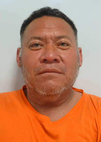
Nino Gonzalez, 44, of Lakeport, California. Lake County Jail photo. LAKEPORT, Calif. — Police have taken a man into custody for attacking a Lakeport Police officer.
Nino Gonzalez, 44, was arrested early Thursday morning, the Lakeport Police Department reported.
At approximately 12:49 a.m. Thursday, a uniformed Lakeport Police officer was at the Shell Gas Station in Lakeport making a purchase when he was confronted by Gonzalez. Police said Gonzalez entered the gas station and charged at and attacked the police officer.
Gonzalez charged at the officer repeatedly yelling that he was going to kill the officer, police said.
In fear for his safety, police said the officer deployed his taser device on Gonzalez but the taser did not make sufficient contact with Gonzalez to have any effect. Gonzalez continued to attempt to grab and assault the officer and the officer created distance between himself and Gonzalez while radioing for additional police officers.
Police said the officer deployed his taser a second time which again did not make sufficient contact with Gonzalez and had no effect.
The officer continued to attempt to create distance between himself and Gonzalez while waiting for backup and Gonzalez continued to charge at and attempt to attack the officer, police said.
After these unsuccessful attempts at deescalation, the officer ultimately drew his firearm and pointed it at Gonzalez. Police said Gonzalez still continued to act aggressively towards the officer and failed to comply with any verbal commands given by the officer.
Backup Lakeport Police officers and Lake County Sheriff’s deputies arrived on scene at approximately 12:50 a.m. At that time, police said Gonzalez made additional threats to the officers and deputies that he was going to kill them and “blow them up.”
The officers physically struggled with Gonzalez but were ultimately able to secure him in handcuffs and place him under arrest, police said.
Gonzalez was subsequently booked into the Lake County Jail for obstructing/resisting a police officer with violence, criminal threats, assault on a police officer, threatening a public official, obstructing or resisting a police officer and possession of a controlled substance.
Police said this is not the first time Gonzalez has been arrested for assaulting or obstructing Lakeport Police officers. Gonzalez has four prior arrests with the agency in which he either attacked or failed to comply with orders given to him by Lakeport Police officers.
Lakeport Police officers, believing Gonzalez to be a significant threat to public safety, later applied for a bail enhancement which was granted by a Lake County Superior Court judge. Gonzalez’s bail was set at $150,000, jail records showed.
LAKE COUNTY, Calif. – It’s that time of year again — for the clocks to move forward.
Daylight Saving Time begins at 2 a.m. Sunday, March 10.
California goes from Pacific Standard Time to Pacific Daylight Time when clocks “spring forward” by one hour.
At this time of year, it’s also a good idea to remember to change batteries in smoke and carbon monoxide detectors as well as in NOAA weather radios.
This year, Daylight Saving Time ends on Sunday, Nov. 3.
Email Elizabeth Larson at This email address is being protected from spambots. You need JavaScript enabled to view it. . Follow her on Twitter, @ERLarson, or Lake County News, @LakeCoNews.
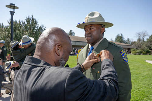
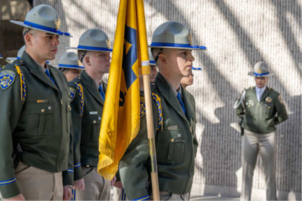
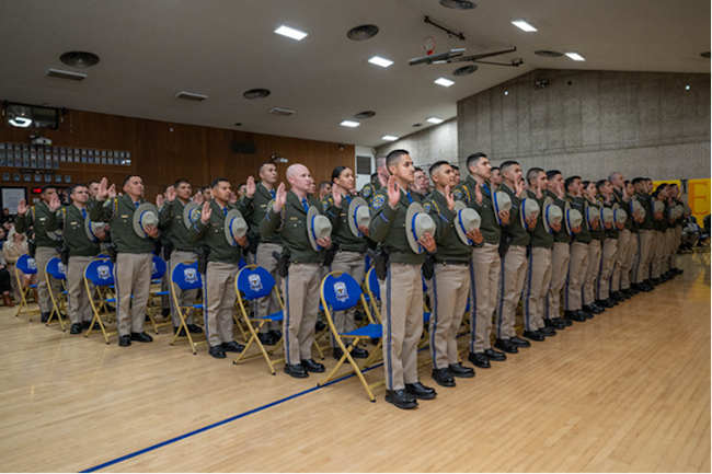
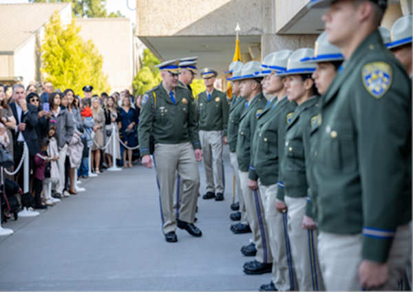
The graduation at the CHP Academy in West Sacramento on Friday, March 8, 2024. Photo courtesy of the CHP. The newest members of the California Highway Patrol were sworn in today during a graduation ceremony at the CHP Academy in West Sacramento.
The 105 officers are part of the CHP’s multiyear recruiting campaign to fill 1,000 vacant officer positions by hiring qualified individuals from California’s diverse communities.
“Today marks a significant milestone in the lives of these new officers. I want to commend these men and women for their dedication and perseverance these past several months while training at the Academy,” CHP Commissioner Sean Duryee said Friday. “Success in training and on the job is only achieved by the most dedicated of individuals. We look forward to working alongside them as we uphold the law and safeguard California’s communities.”
The graduation at the CHP Academy in West Sacramento on Friday, March 8, 2024. Photo courtesy of the CHP. The swearing-in ceremony for the new officers marks the completion of a challenging 26-week journey at the CHP Academy. They will report to one of the more than 100 CHP offices throughout the state to begin serving the people of California.
At the CHP Academy, cadet training starts with nobility in policing, leadership, professionalism and ethics, and cultural diversity. Additionally, cadets receive instruction on mental illness response and crisis intervention techniques.
Training also covers vehicle patrol, crash investigation, first aid, and the apprehension of suspected violators, including those who drive under the influence. Cadets also receive training in traffic control, report writing, recovery of stolen vehicles, assisting the motoring public, issuing citations, emergency scene management, and various codes, including the California Vehicle Code, Penal Code, and Health and Safety Code.
The graduation at the CHP Academy in West Sacramento on Friday, March 8, 2024. Photo courtesy of the CHP. The CHP has seen a significant increase in the number of applications since the onset of its multiyear recruitment campaign in June 2022. To accommodate the surge of interest, the CHP has been holding three Academy classes simultaneously for the first time in the Department’s history. The next cadet graduation from the CHP Academy is scheduled for May 10.
For more information about a life changing career with the CHP, visit the agency’s website and apply today.
The graduation at the CHP Academy in West Sacramento on Friday, March 8, 2024. Photo courtesy of the CHP.
Dennis Fordham. Courtesy photo. In California, under section 17200 of the Probate Code, the trustee or a beneficiary of a trust may petition the court for instructions or other guidance regarding the internal affairs of the trust or the existence of the trust.
Section 17200 has wide scope, and applies, amongst other things, to interpreting the trust, determining the validity of the trust, ascertaining beneficiaries, settling accounts, instructing the trustee, appointing or removing a trustee, requiring an accounting, and much more.
What rights does a person who is neither a trustee nor a beneficiary of the trust have with respect to receiving notice of such a section 17200 petition and then to participating in such trust proceedings?
In Colvis V. Binswanger, 96 Cal. App. 5th 393 (October 13, 2023), the First Appellate District recently addressed that issue.
In Colvis, the trust owned 70 % of the shares in a Company and the remaining 30% was owned by two siblings. The siblings filed a petition under section 17200 of the Probate Code to instruct the trustee to use its 70% ownership to direct the company to borrow substantial sums of money.
The company filed a response to the petition in the trust proceedings. The petitioners objected and argued that the company lacked standing as it was neither a beneficiary nor a trustee. Section 1043 of the Probate Code, however, provides that, “(a) An interested person may appear and make a response or objection in writing at or before the hearing. [and] (b) An interested person may appear and make a response or objection orally at the hearing. The court in its discretion shall either hear and determine the response or objection at the hearing, or grant a continuance for the purpose of allowing a response or objection to be made in writing.”
Who then qualifies as, “an interested person” who may appear, respond and object to a petition by a trustee or beneficiary? Section 48 of the Probate Code provides, “(a) …“interested person” includes any of the following: (1) An heir, devisee, child, spouse, creditor, beneficiary, and any other person having a property right in or claim against a trust estate or the estate of a decedent which may be affected by the proceeding. (2) Any person having priority for appointment as personal representative. (3) A fiduciary representing an interested person.” Thus, creditors and, “any other person have a property right in or claim against a trust estate … which may be affected by the proceeding” are interested persons.
In Colvis, the Appellate Court held that while only a trustee or a beneficiary may initiate a trust petition under section 17200, any interested person may appear, respond and object to the petition. The court considered that section 17203 of the Probate Code which requires notice of the section 17200 petition to be given to interested persons strong indication that interested persons could also appear, respond and object because otherwise given interest persons notice without an ability to participate to protect their interest was meaningless.
Whether a person qualifies as an interested party is specific to the subject of the court proceedings. In Colvis, the court quoted relevant case law precedent, as follows: “The probate court has flexibility in determining whether to permit a party to participate as an interested party. … Thus, a party may qualify as an interested person entitled to participate for purposes of one proceeding but not for another.”
In sum, it makes sense for interested parties to be vigilant and proactive when probate proceedings are involved or are expected.
An interested party might give the trustee written notice that they consider themselves to be an interested party with respect to matters where the affairs of the trust and the interested party overlap and so request that they receive notice of any section 17200 petition involving such matters.
The foregoing brief discussion is not legal advice. Consult a qualified attorney for guidance.
Dennis A. Fordham, attorney, is a State Bar-Certified Specialist in estate planning, probate and trust law. His office is at 870 S. Main St., Lakeport, Calif. He can be reached at This email address is being protected from spambots. You need JavaScript enabled to view it. and 707-263-3235.

 How to resolve AdBlock issue?